UXO search
Unexploded ordnance search on former firing ranges, post-conflict sites and investment areas.

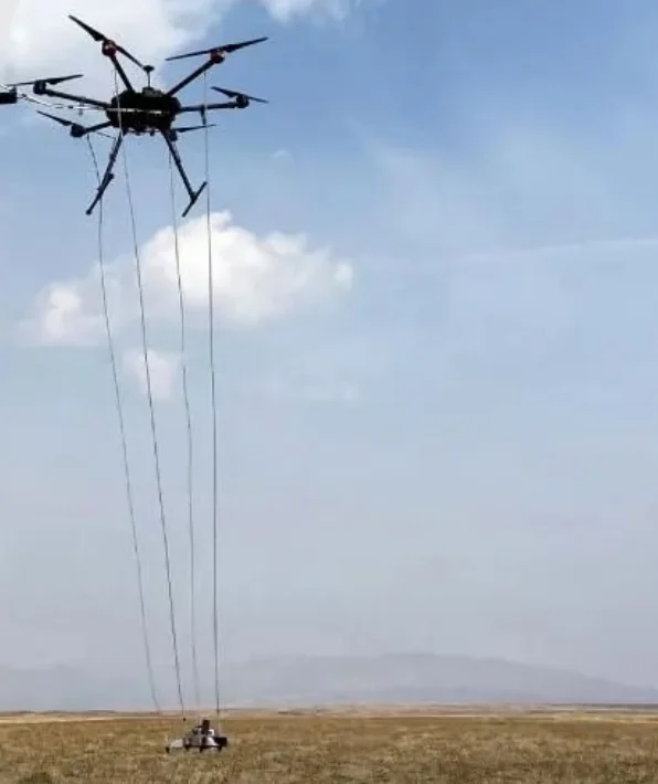
UAV-based magnetic gradiometer system for UXO search, utility detection and archaeological surveys.
Site boundaries and survey lines are planned in the ground control software.
Low-altitude autonomous flight at constant height using a radar altimeter.
OPM gradiometer data is geotagged to cm precision with RTK/PPK and streamed to the ground.
Filtered data becomes an anomaly map, target list and GIS layers.
Unexploded ordnance search on former firing ranges, post-conflict sites and investment areas.
Pre-screening in C-IED and military search activities without exposing personnel.
Anomaly analysis for identifying tunnels, caves and voids.
Locating metal pipes and cables before excavation.
Metal object detection over large areas, including battlefield archaeology.
Surveying deep ferrous metal objects, depending on object size.
DAMASEC’s C-IED and military search experience and the BULUCU system were featured in TÜBİTAK SAGE’s “C-IED activities in Türkiye” presentation at the 6th meeting of the NATO SCI-321 group.
BULUCU is a UAV (drone) based magnetic gradiometer system developed by DAMASEC. It is designed for unexploded ordnance (UXO) search, utility detection and archaeological surveys. The system scans large areas quickly, without sending personnel onto hazardous ground, and locates buried ferrous metal objects with centimetre-level precision.
In 2022, BULUCU surveyed a former firing range of 1.5 million square metres; the 241 items of ordnance detected were cleared and the land was made ready for commercial use. In the same year, the Malazgirt battlefield was surveyed with a drone-integrated magnetometer — a first for battlefield archaeology in Türkiye.
DAMASEC's experience in C-IED and military search activities and the BULUCU system were featured in TÜBİTAK SAGE's "C-IED activities in Türkiye" presentation at the 6th meeting of the NATO SCI-321 research task group on 16 November 2022.
Survey results are turned into magnetic anomaly maps, target lists, GIS layers and excavation/clearance plans, so field teams are directed only to verified targets — reducing time, cost and risk together.
Share the area size, location and your goal, and our experts will send you a suitable survey plan and demo options.